Rattler Range
Rattler Range Navigation Walk – 1st to 3rd of June 2012
Walk Preview:
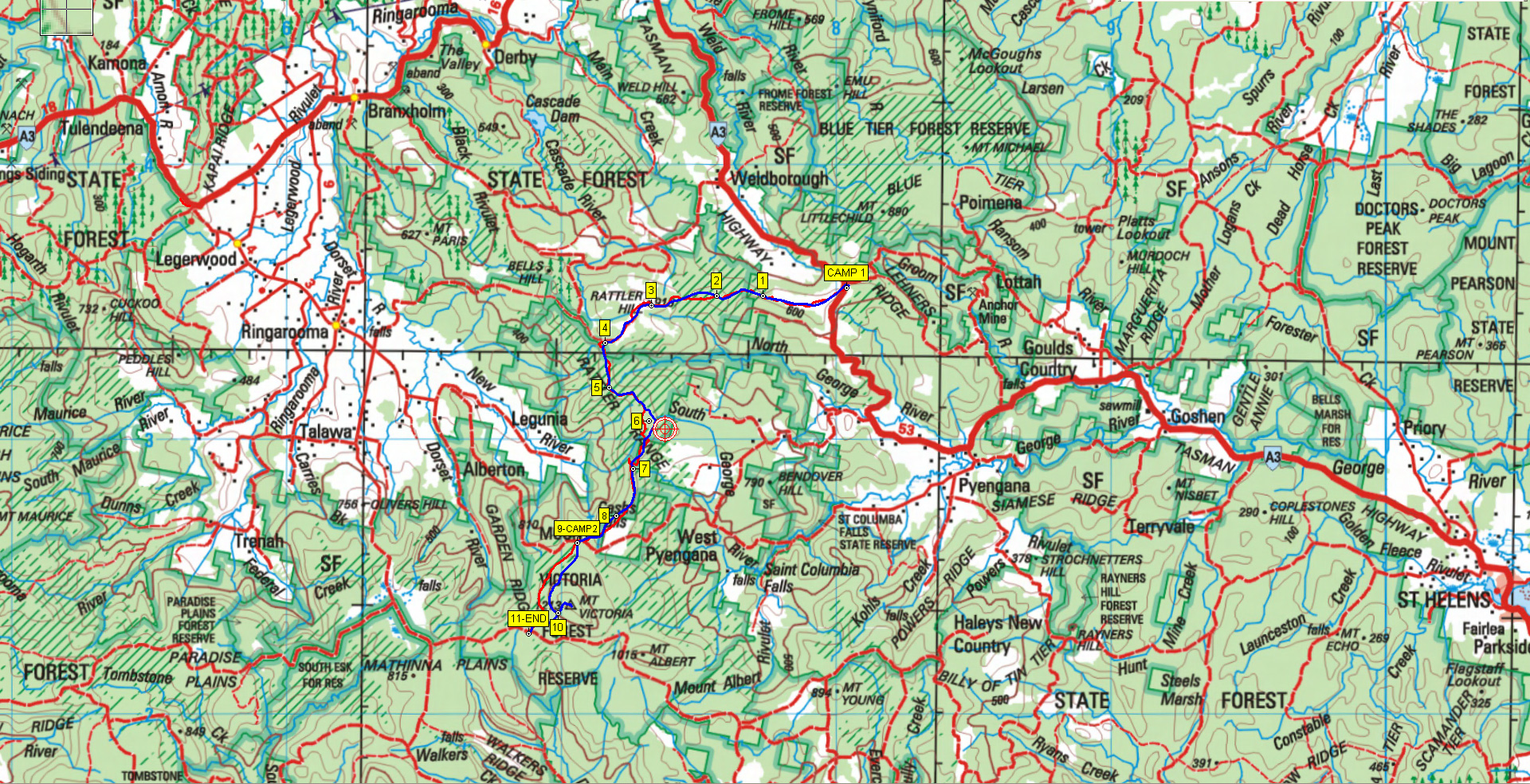
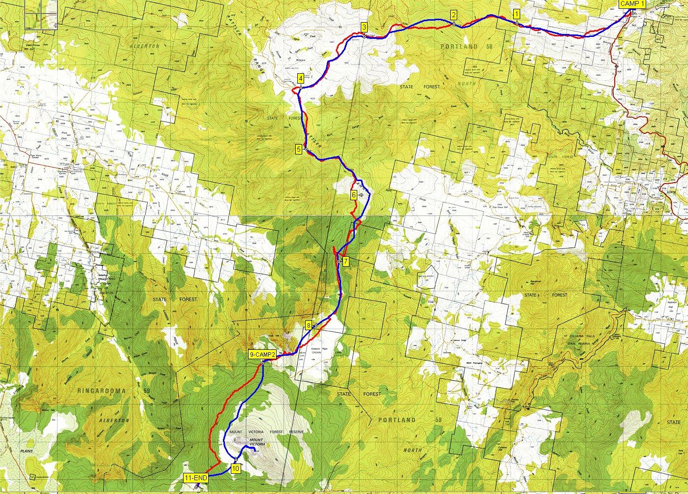
This was my first time with a new walk team and the preview sounded like a challenging task given the time of year and the distance to be travelled. The walk had been cancelled twice before forcing it’s rescheduling to now. The main aim of the exercise was to practice and enhance the off track navigation skills of the team by walking from the Little Plains area (junction of Tasman Highway and Lotta Road) via the Rattler range to Ralphs Falls on Mount Victoria Road, a distance of 20-24km on day one and a shorter day two of 6km from Ralphs Falls to Mt Victoria to our return transport.
Eight team members made the bus for the journey to the overnight camp location at Little Plains, with the ninth to join us at camp later that night. After the required paperwork and the usual packing and organisation we hit the road Friday night at the planned 6PM on the bus. Arrival at Scottsdale was welcome by all and tea was duly ordered from the local eatery. Our assistance driver 'RM' was phoned and organised to meet the bus at Mount Victoria car park and return the bus driver and our 9th member ('JH') back to Little Plains where the rest of us had hoped to get a bit of extra sleep.
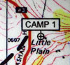 The bus dropped us all at Little Plains around 9PM as planned and we started to setup camp on the edge of the plantation. The bus left for the rendezvous with our shuttle driver 'RM' at Mt Victoria. We all gathered around a gas camp light like moths to a street light for a while before we retired one by one for the 5:45AM start. Around midnight 'RM' had shuttled the bus drivers and our 9th team member 'JH' from Mount Victoria back to the campsite. Just in case we missed their arrival a goodbye blast of siren and lights did the trick!
The Walk:
Up well before 6AM, breakfast, pack up, maps issued, briefing on the day ahead and the first team member was on a bearing leading us across the open hills by 7AM and on schedule as the daylight became stronger and the first hints of sun below the horizon to the East. We had a great view of the oddly named Bendover Hill in the distance to the South. We had been paired off into two person teams for the rest of the day. The day was broken into sections where each team member would take control leading along the route with assistance from their paired ‘buddy’ and the walk leader if required. The object was to use only map, compass, the features of the land and your head to get us to the start of the next section marker and hand over to the next person.
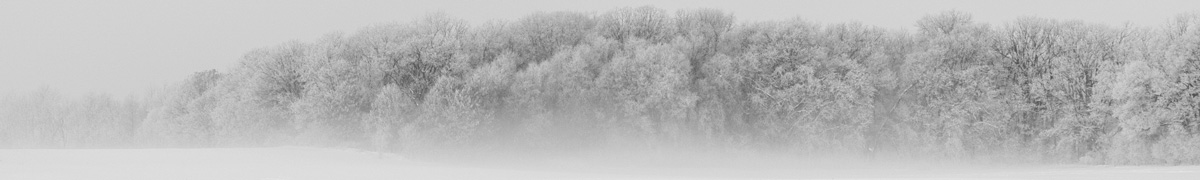
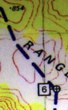
We crossed some open hills and plantations before arriving in one of the most magnificent myrtle forest with massive old trees and lots of fungi and moss. We paused for a quick photo 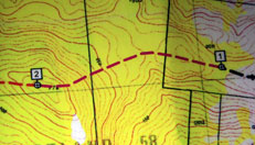 at the headwaters of Le Fevre Creek as we crossed it. Good navigation was required here with few references other than the crests, contours and the compass in the thick forest. We emerged onto Rattler Hill a bit behind schedule after walking up the final part beside a clear felled section on the NE side of the ridge. The ground was now much more open and visual references made the next couple of sections easier to navigate. The edge of the rainband could be seen in the distance behind the Rattler Hill trig with a few sprinkles along the way.
 After a quick lunch stop to get fed, watered and to take on some well needed drugs for a couple of us we he headed back onto the track and soon after back into the forest following an old vehicle track initially that petered out into overgrown bush at the base of an unnamed hill. We picked up another narrow muddy bike track that went in the right direction and got us to point 5 in a clearing, possibly from an old sawmill in the past.
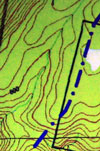
 Keeping to the ridge lines we headed towards point 6 and what the map showed as a large open clear area. We came down off a ridge line at 854M towards the map clear area. What we found initially was thick cutting grass and tea tree as we went towards the next high point before point 6. The way ahead soon turned into thick bauera scrub and tea tree. Starting on our hands and knees and then pushing through the scrub we gained the rocky ridge line where the rain started to get heavier, the cloud was on the ground and the coats came out and remained on for the rest of the trip. Scouting around for suitable routes it became obvious there was no option but to push through the bauera scrub on a bearing along the ridge line. It was becoming more difficult to read the maps in the cloud and low light even though it was only around 3PM in the afternoon. Headlamps started to appear and remained on for the duration as it got darker.
 Having had several things combine and accumulate to slow our progress it became obvious we needed to press on and use all options available to expedite the rest of the journey as the estimated finish time was now well after our original planned estimate. It was now getting very dark in the forest as the bauera scrub started to open up and walking with headlamps was the only safe option. We decided to take a grid reference on the GPS to allow an accurate bearing to be taken by knowing our exact, rather than approximate position. We continued on through the forest in pursuit of point 7 but we just strayed off track slightly and ended up on the wrong spur about half way there. Another grid reference was taken to re-confirm what we knew and we recovered down through a steep gully back onto the correct spur.
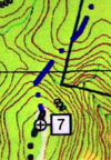 We came off the ridge just before point 7 to a complicated and very deep gully with a shear cliff on one side that we exited directly above. The rain was heavier and quite steady now and the ground required great care to navigate down into the creek at the bottom. We kept high for a bit and then dropped down into the creek and moved along looking for the saddle using the creek as a reference. This proved to be a bit fruitless and we went past the point we should have ascended the ridge. We stopped briefly to fuel up with some snacks and drinks before the final push up to point 7 and the rest of the journey. It was just before 7PM when we reached point 7.
The rest of the trip to just before point 8 where we intersected the button grass on Cotton Plains was a combination of pushing through Tea Tree, open forest and a bit of non-descript scrub in places. Reaching the button grass on the Cotton Plains just before 8PM was a welcome sight for quite a few weary bodies, but the trip was far from over yet. Pushing through more Tea Tree, quite a decent stretch of button grass with tired legs and some quite steep uphill and downhill sections zapped all but the last bit of energy of most team members. A particularity dangerous decent into Cashs Gorge on extremely slippery and loose rocks topped off the last section of the trip and then a not so quick blast up the last bit on boardwalk to the shelter arriving just before 9:30PM.
The Walk End:
Hot drinks, dry clothes and warmth the order of the day on arrival at the shelter. Most had warmed up after a hot drink, warm clothes or jumping into a sleeping bag. Some left it at that and others got stuck into dehydrated meals and snacks. Eventually several tents went up next to the shelter and three decided to sleep in the shelter itself risking a midnight lick from a possum. The rain and wind did not stop and greeted us again the next morning with higher winds than the day before. Mt Victoria was going to be a non event today so we packed up and walked around the 940M contour to join the Mt Victoria summit track and directly down to the bus and home. A pie and chip stop at Scottsdale raised the energy levels on the way back home to a very cold southerly at Youngtown and a quick chat before we all departed for home after an epic weekend exercise.
A great team effort and great company. We all pulled through together and made the walk an enjoyable and memorable weekend adventure.
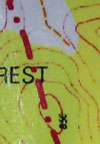
RED = actual route taken, Blue = approximate route we had to follow
Comments
Rattler Range — No Comments
HTML tags allowed in your comment: <a href="" title=""> <abbr title=""> <acronym title=""> <b> <blockquote cite=""> <cite> <code> <del datetime=""> <em> <i> <q cite=""> <s> <strike> <strong>